

Our Tech.
Private industry has developed incredibly powerful enterprise tools for exploiting natural resources.
We’re giving the same tools a new purpose: conservation.
CTA has invested in a garage of adaptable solutions, taking on initial cost burden and handling implementation.
Our engineering experience includes population counts, landscape surveys, and animal tracking.
CTA has invested in tools suited to a broad diversity of conservation data collection.
We maintain this garage of tech and we work with many other tools such as camera traps and on-animal tracking devices such as collars.
While this garage is useful to have in-house, it’s also designed to accommodate new tools as necessary – we are not limited to the payloads, tools, and software listed here for solving new problems.
TECH STRATEGY.
SOFTWARE AND ANALYSIS
Myriad software is used in our workflows. Individual functions include: mission planning, processing LiDAR data and generating point-clouds, creating orthomosaics, object identification, and more.
Contact us to learn more about our workflows, software, and analysis capabilities.

IMAGING / SENSORS
Imaging technology is the heart of gathering our data. Beyond traditional cameras, we use thermal, LiDAR, and multi-spectral sensors to collect the most relevant data for each project.
Our current sensors include:
45MP full-frame camera with a 35mm lens. This camera captures “traditional” images which can be used to colorize LiDAR pointclouds or create high resolution orthomosaic images.
ZENMUSE P1
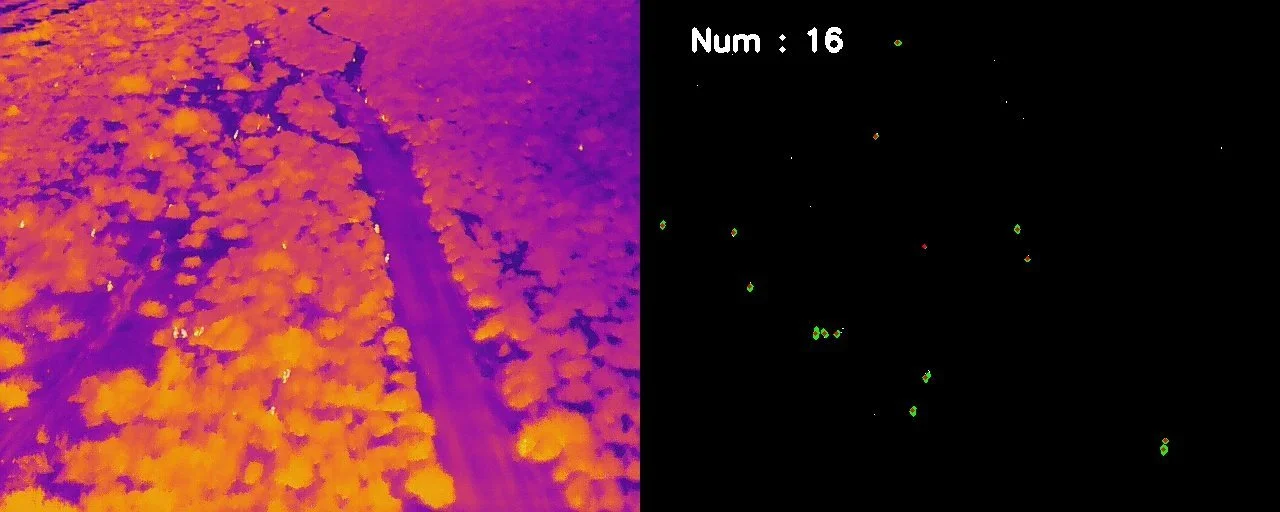
Aside from the zoom camera and laser range finder, the H20T’s most useful function in animal population surveys is its 640×512 px radiometric thermal camera. This allows temperature data to be collected in an image format.
ZENMUSE H20T
Frame LiDAR System with 4/3 CMOS RGB with up to 5 returns with a maximum of 240,000 pts/sec. 5 returns means better canopy penetration.
ZENMUSE L2
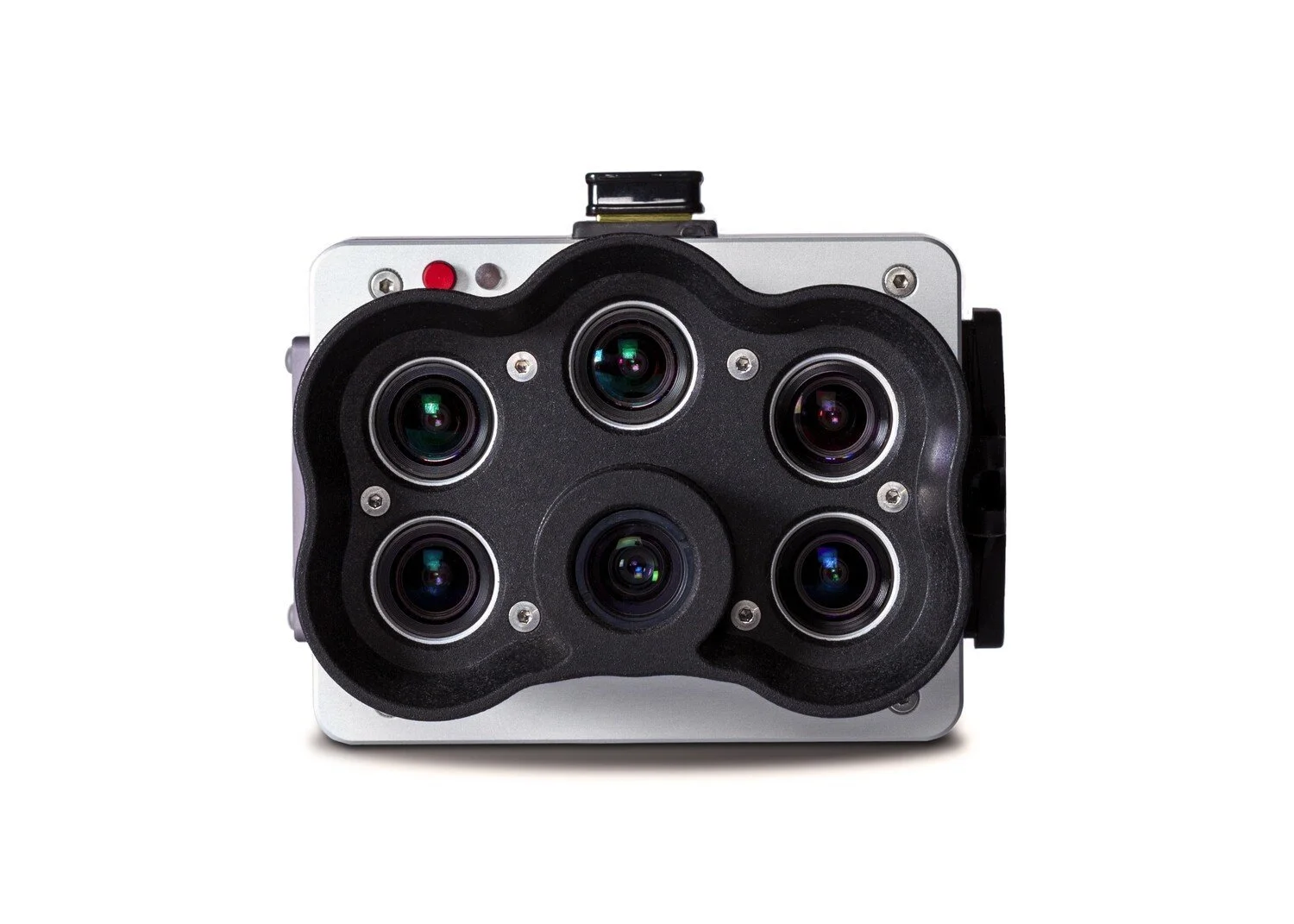
5-Band Multispectral each at 1.6MP. Each camera collects data in its specific spectral band, which can then be used to create orthomosaic images with indices that relate to plant health.
MICASENSE REDEDGE-P
PLATFORMS
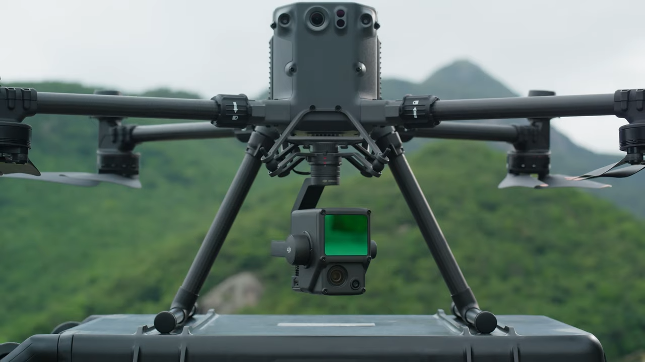
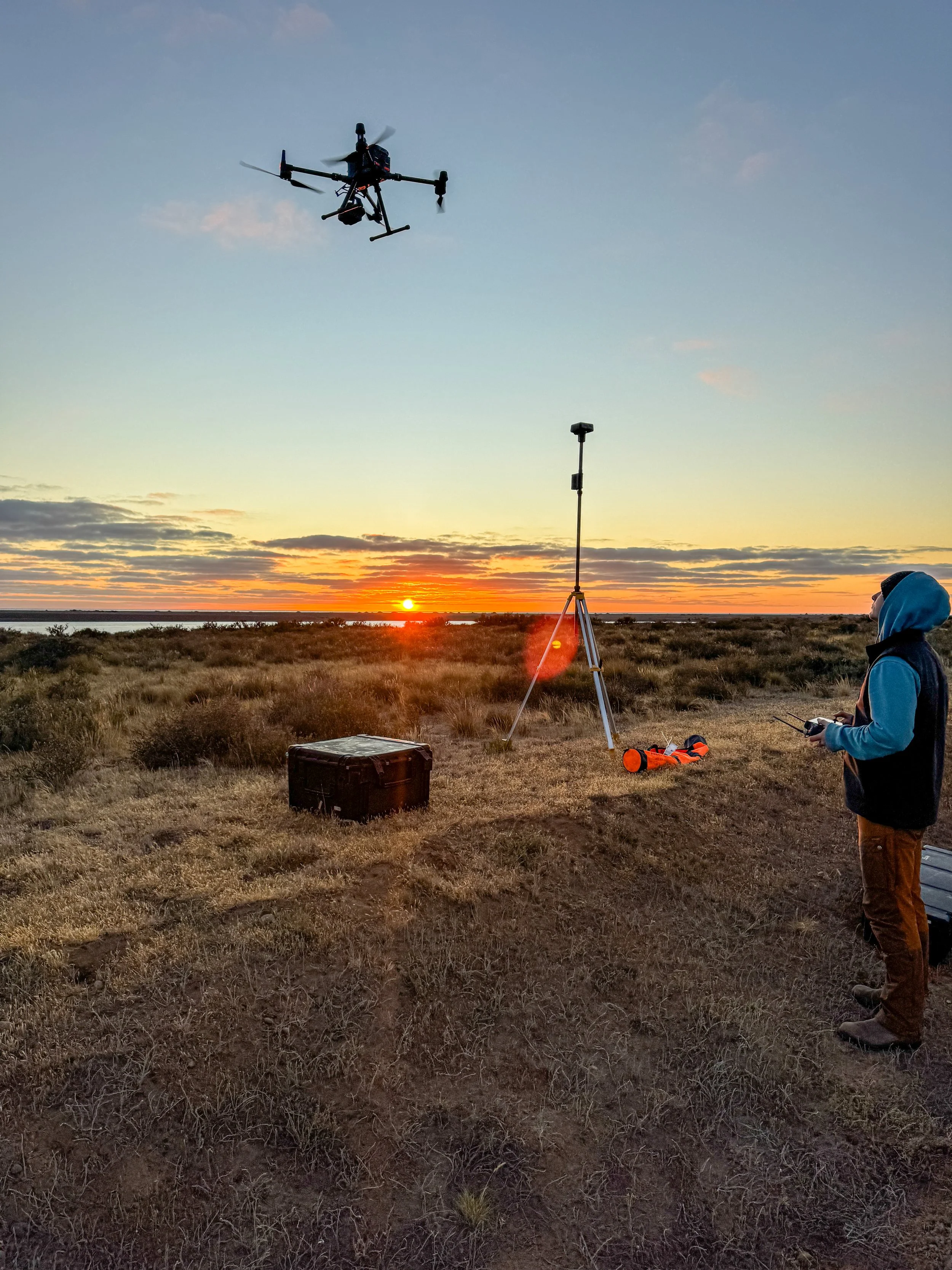
DJI M350 RTK
Drones enable access and efficiency previously not possible with larger vehicles or on foot. Our DJI M350 RTK is DJI’s flagship enterprise drone, capable of vertical take-off, carrying payloads up to 2.7 kg and a maximum flight time of 55 minutes. It is the perfect platform to perform smaller-scale surveys, test equipment and explore the advantages and viability of ready-to-fly (RTF) systems for our partners.
SKYFRONT PERIMETER 8
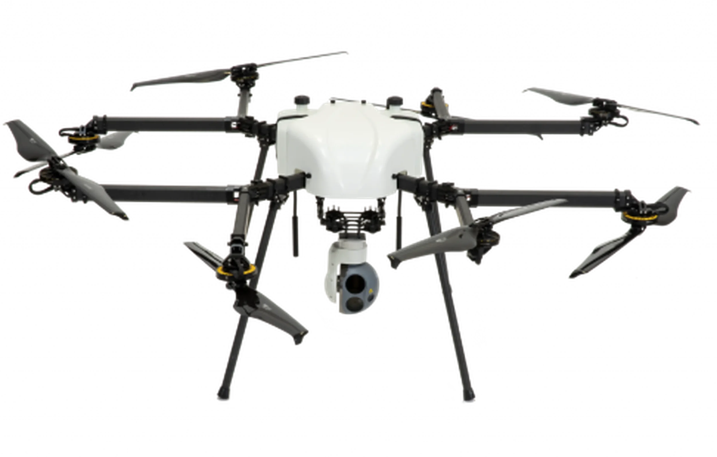
The Skyfront Perimeter 8 is a hybrid drone that dramatically increases our flight time and payload capacity with up to 5 hours and 22lbs respectively.
Increasing payload weight allows us to carry higher quality sensors and fly higher, covering more area in less time.
More flight time means less time swapping batteries and more data collection.